15 Kilometers of Solidarity: The Other Side of Small Island Resilience
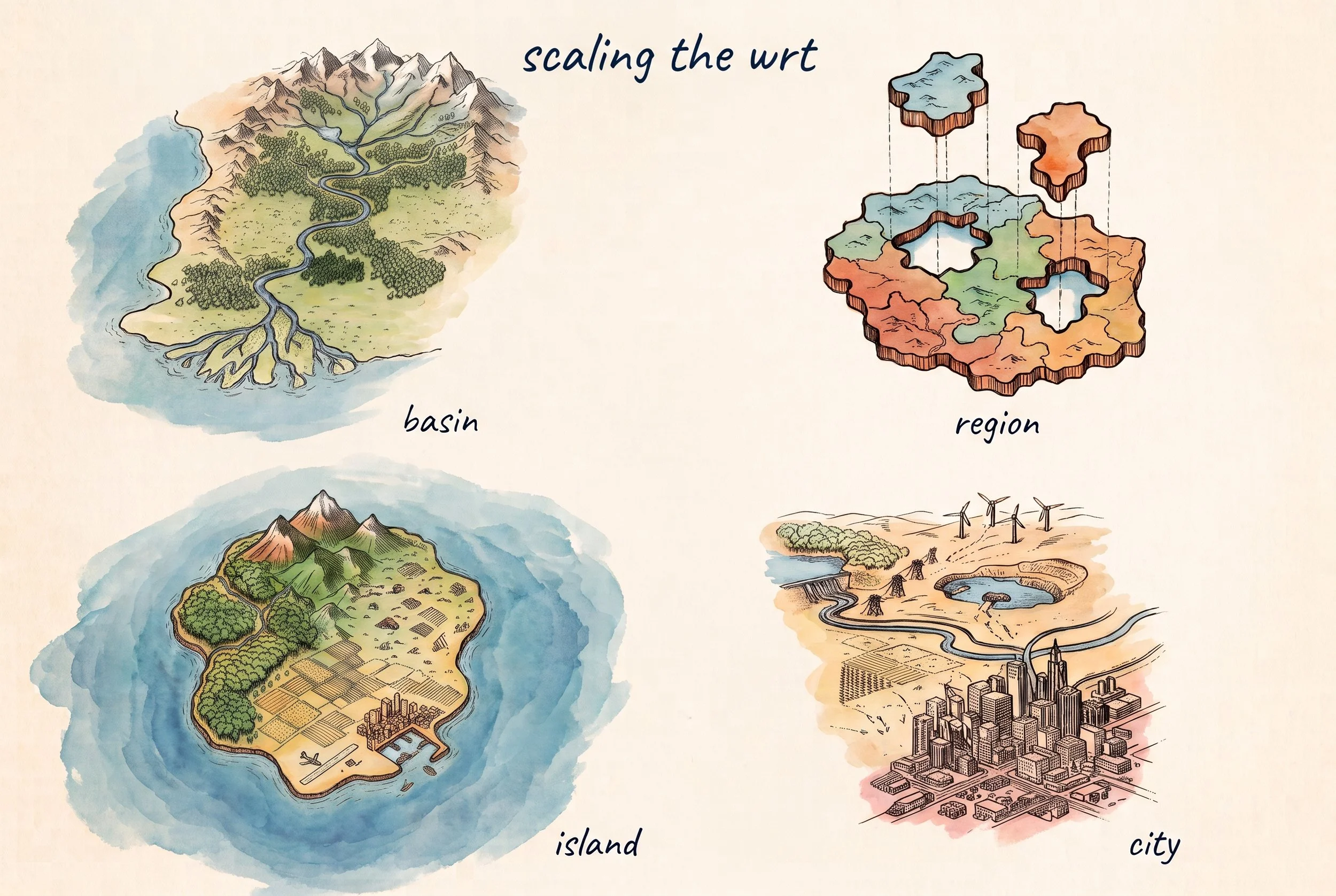
AI generated image, Google Gemini, October 2026
More than twenty years ago, an old friend told me a story that has stayed with me. He worked for the Indonesian government, and whenever a crisis hit, he was flown in to handle it. On different occasions, and on different islands, the crisis was drought. Crops had failed and families faced starvation. Many times, he would arrive in an island’s main town to find people washing motorbikes in the street and watering their lawns. Meanwhile, a mere fifteen kilometers or so away, on another side of the island, people were running out of food.
His question was simple: how can this happen?
The answer seems moral; shut off the taps in town, stop washing the motorbikes, and give that water to the farmers. But this would not have saved a single crop.
The answer is more complicated and typical to a small island setting. That is probably why the question stuck. A small island is like a continent folded into a few hundred square kilometers. Within a short drive, the wet windward slopes turn into a dry rain shadow. Volcanic soils hold water and limestone lets it drain away. Along the coast, fresh water floats as a thin lens on the sea. A small island can hold several water systems, and each one fails in its own way. Yet disaster response is ideally organized at the island level. Part of the problem is hydrological, but it still is also a question of solidarity.
In reality, the town and the farms draw on separate water systems. Water saved in town stays in town. Connecting the two systems is partly an engineering challenge, but mostly an operational one. Where drought is occasional, an early warning system triggers emergency water transfers into a diversion. Where scarcity is structural, the connection requires permanent infrastructure. But in both settings, the pipes or canals only function if you have adaptive operating rules to govern them. Once both systems are joined, washing the motorbike becomes a real choice, because a neighbour in need waits at the other end of the pipe.
So how does this happen? A classic risk assessment maps where the hazard strikes and who is exposed. The dry side of the island lights up red on the map, and each place sits in its own box. A resilience lens asks a different question: does the island as a whole keep drinking water, food, and livelihoods going as conditions change? And can the island adapt or transform when conditions change for good?
Climate Risk Informed Decision Analysis (CRIDA) starts from climate risk. We are currently rolling out a resilience framing to CRIDA to make exactly this shift, including a stress test for island water governance.
The stress test divides the island into zones by water system, looking at climate and ecology. Every zone then faces the same modeled shock. The test evaluates the island by its worst-served zone, based on what local stakeholders experience. The hungry hillside shows up no matter how comfortable the town looks. The test also asks whether water, money, and decisions can move between zones. On many islands that sit within a larger country, the island-level authority to make those moves simply does not exist.
While stress testing shows where an island bends and breaks, the Water Resilience Tracker (WRT) asks whether policies and institutions can carry the response. The WRT has already moved below the national level to basin plans in Brazil and Malawi, districts in Nepal, and governorates in Egypt. We are now adapting the WRT questionnaire for local plans. Basins, cities, provinces, sectors, and small islands each become a level of their own.
An island assessment starts on the island and works outward. Vertical questions look up to provincial and national plans and budgets. Horizontal questions look across to neighbours who share the same drought. For small islands, external links also need to be diagnosed for climate resilience, since those links are often essential lifelines. The WRT partners are still testing this approach and actively looking for small island settings and partners to help roll it out.
My friend's question has an uncomfortable answer. The drought on the far side of the island was a matter of connectivity. The water was a short drive away. The canals, budgets, and mandates to move that water were missing. I lost touch with my friend over the years, and he has since passed away. But I think of him whenever we do this work, because resilience turns solidarity into something you can actually build. People in town can then play their part, knowing the water they save actually reaches someone. The old proverb says a friend in need is a friend indeed. The island context calls for a more pragmatic phrasing: a friend in deed is the friend you need.
Nikolai Sindorf
Delft, Netherlands, October 2026
This essay is the story that did not make it into the talk at the Water Under Pressure webinar, so it is put in context for this essay. The session opened the "From Nadi to Antalya | Spotlight on SIDS" webinar series by the UNEP Copenhagen Climate Centre, the NDC Partnership, the Center for Access to Climate Finance, and GIZ. GIZ’s Water4Future initiative graciously provided the space to the WRT to present its approach in this first session of the webinar series. Two more sessions follow on 22 and 29 October, and registration is open. We are keen to apply the WRT with SIDS governments and approach donors together. If your island is asking my friend's question, or if you are an interested donor, get in touch with Idrees Malyar: imalyar@alliance4water.org
Enjoy reading essays like this? Please subscribe to the AGWA family of newsletters! You can join AGWA and subscribe here.